
Because every project deserves a better vantage point.
Our certified remote pilots follow careful, disciplined flight practices and use the latest drone technology to capture high-resolution imagery for a wide range of commercial needs.
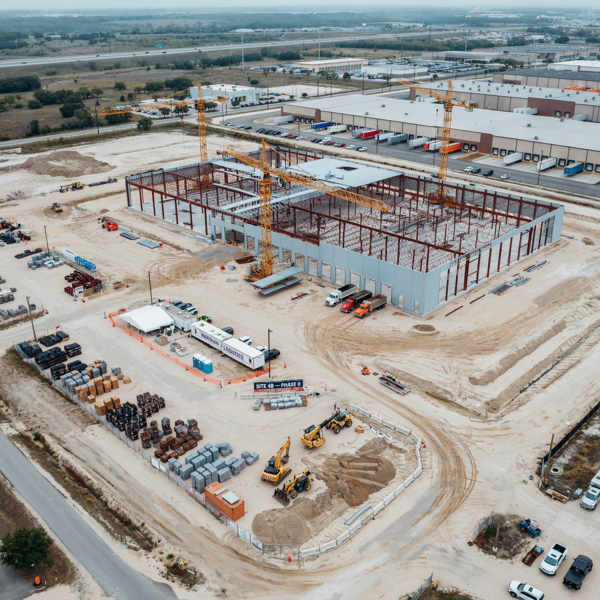
Construction Progress Documentation
Keep Every Stakeholder in the Picture — From Groundbreaking to Grand Opening
Whether you're managing a commercial development, residential subdivision, road project, or infrastructure build, Excelsior Aerial Solutions provides scheduled aerial photography and mapping that gives you a comprehensive, chronological visual and data record of your project's progress.
Aerial progress photography does more than document — it communicates. Investors, owners, and project managers get a clear, bird's-eye view of site conditions, phase completions, and overall progress without ever setting foot on site. When questions arise about scheduling, scope, or site conditions, your aerial record provides an objective, timestamped reference that protects everyone involved.
What You Can Expect:
Scheduled shoots aligned to your project milestones or at regular intervals — weekly, bi-weekly, or monthly
Consistent flight paths and angles across sessions for true apples-to-apples comparison
High-resolution aerial still photography delivered as unedited image files
Fast turnaround — typically within 24 hours of each shoot
A growing visual archive that tells the complete story of your project
Beyond Photography: Mapping & Measurement
For projects that need more than just visual documentation, we offer orthomosaic mapping and photogrammetry processed through the PIX4Dcloud platform. These high-accuracy 2D maps and 3D models let you measure distances, track earthwork volumes, and verify site conditions against your plans — turning your aerial imagery into actionable data alongside your visual record.
Ideal For: Commercial construction, residential developments, road and infrastructure projects, agricultural facility builds, and any project where documented visual progress — or precise site data — has operational or legal value.
Contact us to discuss a progress documentation and mapping schedule tailored to your project timeline and budget.
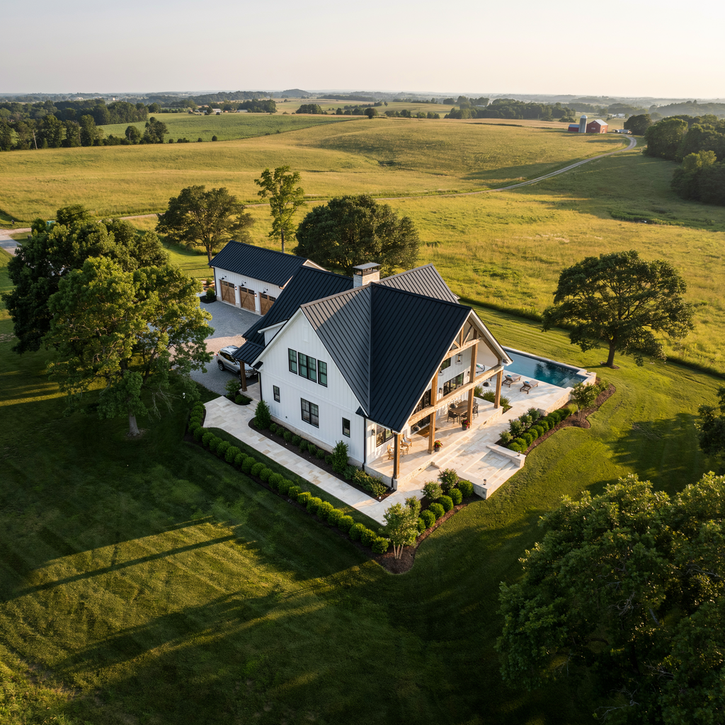
Real Estate Listing Photography
Show Buyers the Full Picture — and Sell Faster
In today's competitive real estate market, listings with aerial photography consistently attract more views, generate more inquiries, and sell faster than those without. Excelsior Aerial Solutions gives real estate agents and property owners a powerful visual tool that showcases not just the property itself, but its surroundings, access, acreage, and setting in a way no ground-level camera ever could.
From rural acreage and lakefront properties to residential neighborhoods and commercial listings, aerial photography transforms how buyers experience a property before they ever visit in person. In areas like the northwest and capital region where land, water, and open space are major selling points, the view from above often tells the most compelling story.
What You Can Expect:
High-resolution aerial still photography of the property, structures, lot lines, and surrounding area
Multiple angles and altitudes to showcase the property's best features
Fast turnaround — typically within 24 hours of the shoot
Delivered as high-resolution unedited image files ready for your MLS listing, website, or marketing materials
Ideal For: Residential listings, rural and agricultural properties, lakefront and waterfront properties, commercial real estate, vacant land, and new construction listings.
Contact us to schedule a shoot around your listing timeline — quick turnaround is our standard.
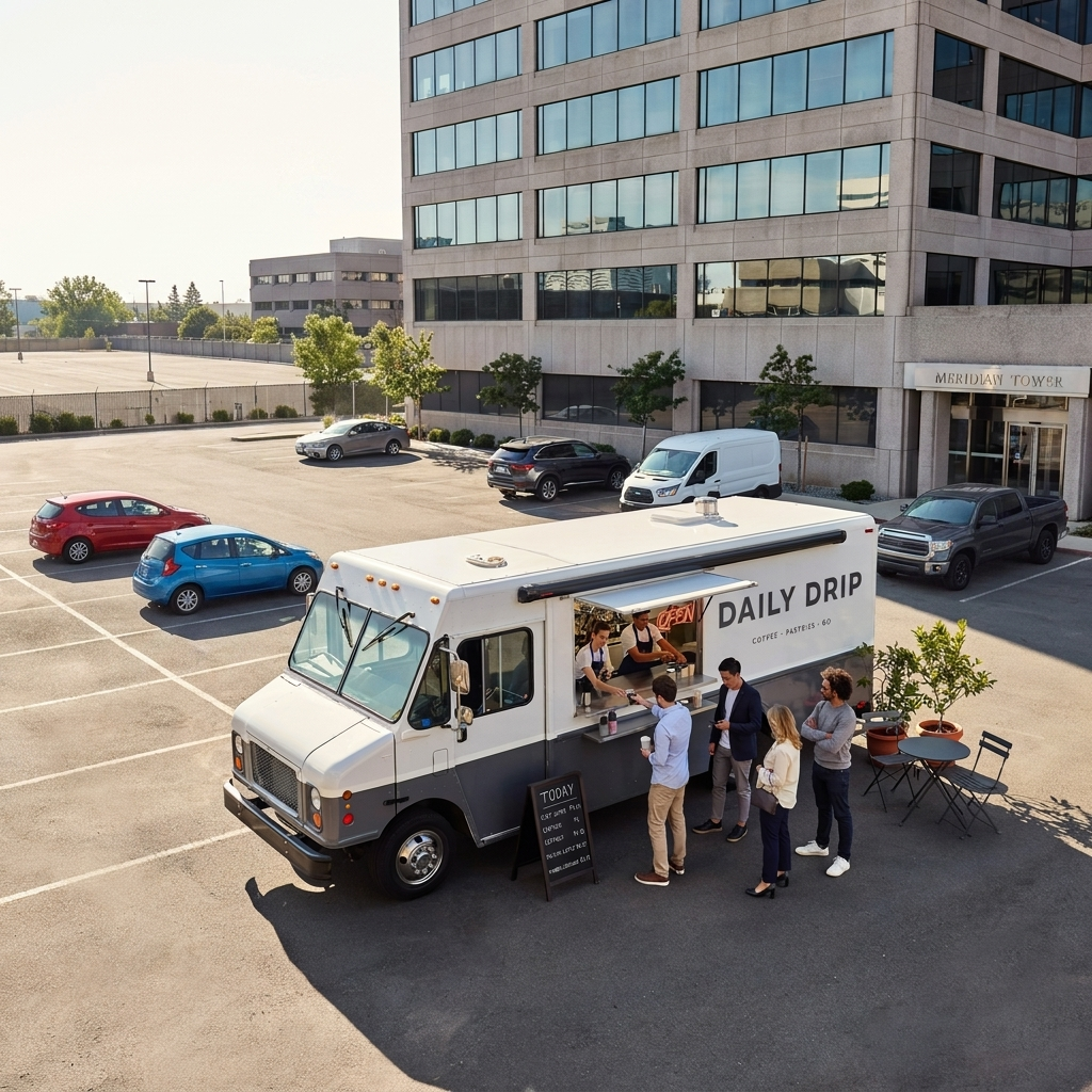
Marketing & Promotional Photography & Videography
Give Your Brand a Perspective Nobody Can Ignore
Aerial imagery stops people. Whether it's scrolling through a social media feed, browsing a website, or watching a video, a stunning shot from above commands attention in a way ground-level content simply cannot match. Excelsior Aerial Solutions delivers professional aerial photos and raw video footage that give your marketing team the high-impact visual assets they need to tell your brand's story from an unforgettable angle.
From showcasing your facility or campus to capturing the scale of your operation, aerial marketing content communicates size, scope, and professionalism instantly. We capture the shots — your creative team takes it from there.
What You Can Expect:
High-resolution aerial still photography from multiple angles and altitudes
Raw aerial video footage in high resolution
Collaborative pre-shoot planning to ensure we capture exactly what your campaign needs
Delivered as unedited photo files and raw video footage — ready for your creative team, graphic designer, or video editor to work with
Excelsior Aerial Solutions does not provide post-production, color grading, or video editing services
Ideal For: Business and facility showcases, agricultural and industrial operations, tourism and hospitality marketing, campus and property overviews, social media content, website hero imagery, and advertising campaigns.
Contact us to discuss your project — we'll plan the shoot around your creative brief and timeline.
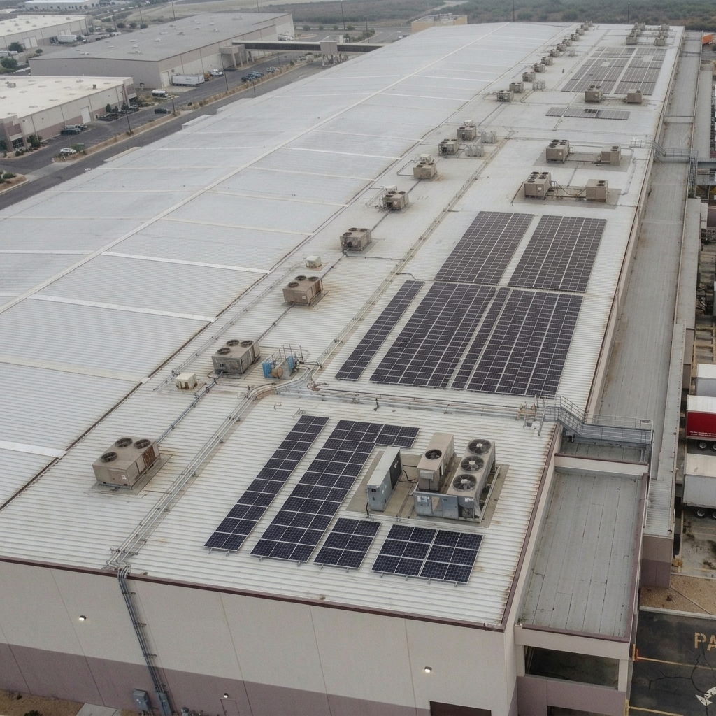
Inspection Services
A Safer, Smarter Way to Assess Hard-to-Reach Structures
Traditional roof and structure inspections are time-consuming, physically demanding, and carry real safety risks for inspectors. Excelsior Aerial Solutions puts a professional drone in the air instead — delivering detailed, high-resolution imagery of roofs, facades, gutters, chimneys, drainage systems, and other structures quickly, safely, and at a fraction of the cost of traditional methods.
Our drone-based inspection service is ideal for situations where access is difficult, conditions make physical inspection dangerous, or you simply need a fast visual assessment before committing to a full inspection or repair crew. The result is a comprehensive set of high-resolution images that give you a clear picture of conditions from every angle.
What You Can Expect:
Close-up, high-resolution aerial imagery of roofs, structures, and hard-to-reach areas
Multiple passes at varying altitudes and angles for thorough coverage
Delivered as high-resolution unedited image files your team can review, annotate, and share
Fast turnaround — typically within 24 hours
Safe, non-invasive assessment with no ladders, lifts, or physical access required
Ideal For: Residential and commercial roof assessments, storm damage documentation for insurance claims, pre-purchase property inspections, cell tower and antenna visual checks, agricultural structures, grain bins, and any structure where physical access is difficult, costly, or dangerous.
Contact us to schedule an inspection — most assessments can be completed in a single visit.
Event Photography & Videography
Capture the Full Scale of Your Event From Above
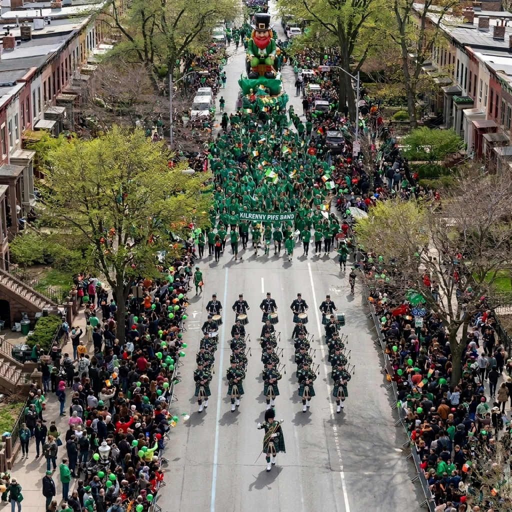
Some moments are too big to capture from the ground. Excelsior Aerial Solutions brings a professional aerial perspective to your event — delivering stunning overhead coverage that captures the energy, scale, and atmosphere in a way your guests will never forget and your audience will always remember.
Whether it's an outdoor festival, a wedding, a fundraising event, a community gathering, a sporting event, or a private celebration, aerial coverage adds a dimension of visual storytelling that sets your event content apart. We handle the flight — your production team handles the rest.
What You Can Expect:
High-resolution aerial still photography throughout your event
Raw aerial video footage capturing key moments, crowd scale, and venue atmosphere
Pre-event coordination to plan flight windows, restricted areas, and key moments to capture
Delivered as unedited high-resolution photo files and raw video footage — ready for your editor or production team
Excelsior Aerial Solutions does not provide post-production, editing, or finished video production services
All flights conducted in full compliance with FAA Part 107 regulations
Ideal For: Outdoor festivals and fairs, sporting events, fundraisers and charity events, community gatherings, agricultural events, concerts, and private celebrations held in suitable outdoor locations.
Contact us early — event availability fills quickly and airspace coordination may be required depending on your venue location.
Request a Customized Proposal
Fill out the form to get started. We'll talk through your needs and map out the right aerial approach for your project.